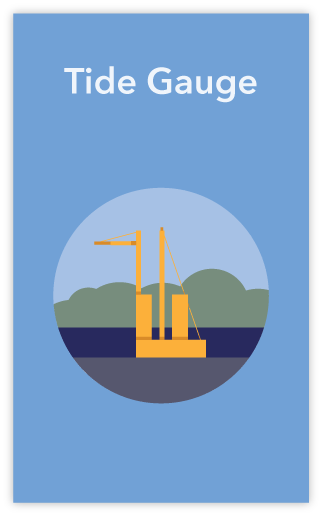
 Sea level is a critical variable of our environment and has a high impact on coastal populations. Tide gauges are an important tool to determine trends in mean sea level, extreme conditions (and their relation to climate change), tidal computation, geodetic applications, harbour operations and navigation, as well as sea level hazards warning systems (tsunamis and storm surges).
Recognizing this critical and increasing need of tide gauge data, EuroGOOS Tide Gauge Task Team is bringing together the tide gauge communities in the European and adjacent seas. The EuroGOOS Tide Gauge Task Team compiles information on existing sea level networks, advises operators and scientists, and supports national and regional sea level initiatives towards enhanced and sustained system.
EuroGOOS Tide Gauge Task Team is a European network of tide gauge platforms. The Task Team assists its members with operational requirements, such as standardization of tide gauge operations, data and applications of multi-purpose networks, based on the Global Sea-level Observing System (GLOSS) and the requirements set by the Intergovernmental Coordination Group for the Tsunami Early Warning and Mitigation System in the North-eastern Atlantic, the Mediterranean and connected seas (ICG/NEAMTWS). It sets out a framework for collation of a single database describing the in-situ monitoring equipment and its status across Europe. Task Team members share success stories and discuss common challenges, including analysis of the funding strategies and importance placed on this work in different countries.
The EuroGOOS Tide Gauge Task Team works to:
- Promote the integration of tide gauges in European initiatives and identify relevant products required by sea-level data users;
- Link national agencies of tide gauge operators with data providers acting as the European component in GLOSS;
- Promote research and tests of new sea-level monitoring technologies;
- Promote the recovery of historical data and related studies;
- Contribute to the development of the European Ocean Observing System (EOOS) with the identification of duplication and/or gaps in the geographical coverage and in the existing sea level data portals in Europe.
At the operational level, the Tide Gauge Task Team:
- Acknowledge existing data portals and ensure data availability according to the different applications;
- Promote the co-localisation and use of additional instrumentation relevant for sea level applications such as ocean bottom pressure sensors, land movement monitoring stations (GNSS), atmospheric parameters, and tsunami sensors;
- Ensure the implementation of new requirements on sea-level quality control and data processing;
- Provide recommendations (from operators to end-users) on data requirements and interoperability, quality control, complementary instrumentation (through interaction with other groups, e.g. GNSS).
Tide Gauge Metadata Inventory
Led by the EuroGOOS Tide Gauge Task Team, and part-funded by the H2020 EuroSea project, an online live, managed tide gauge metadata catalogue for all permanent tide gauges along European and adjacent coastlines in now in version 1.0 of its development. This Tide Gauge Metadata Inventory is designed to address inconsistencies and omissions in metadata across European tide gauge data portals, enabling tide gauge operators to populate a single centralised tide gauge inventory with comprehensive metadata, which can then be accessed by data portals and data aggregators to standardise their own metadata records.
The Tide Gauge Metadata Inventory is now available for population by tide gauge operators!
Please address any queries on how to edit the information on the metadata inventory to Guy.westbrook AT marine.ie
List of Members
Co-chairs
- Angela Hibbert, National Oceanography Centre (NOC), United Kingdom
- Elizabeth Bradshaw, British Oceanographic Data Centre (BODC), United Kingdom
Members
- Andy Matthews, Angela Hibbert, National Oceanography Centre, UK
- Anna Gyldenfeldt, Bundesamt für Seeschifffahrt und Hydrographie (BSH), Germany
- Antonio Novellino, ETT Solutions, Italy
- Arianna Orasi, Istituto Superiore per la Protezione e la Ricerca Ambientale (ISPRA), Italy
- Athanasia Papapostolou, Hellenic Centre for Marine Research (HCMR), Greece
- Begona Perez Gomez, Puertos del Estado, Spain
- Daniele Galliano, Joint Research Centre (JRC), Italy
- Deirdre Fitzhenry, Marine Institute, Ireland
- Dominique Obaton, IFREMER, France
- Elizabeth Bradshaw, British Oceanographic Data Centre, UK
- Endri Qershija, State Authority for Geospatial Information (ASIG), Albania
- Fabio Raicich, Consiglio Nazionale delle Ricerche (CNR) Istituto di scienze Marine, Italy
- Fernando Manzano, Puertos del Estado, Spain
- Francisco Hernandez, Vlaams Instituut voor de Zee (VLIZ), Belgium
- Georgios Sylaios, Democritus University of Thrace, Greece
- Geraldes Dias, Portuguese Hidrographic Institute, Portugal
- Guy Westbrook, Marine Institute, Ireland
- Guy Woppelmann, Univ La Rochelle, France
- Ivan Haigh, Univ Southampton, UK
- Ivica Vilibic, Ruđer Bošković Institute, Croatia
- Khalid El Khaklidi, Chouaïb Doukkali University, Morocco
- Luisa Lamas, Luis Melo, Instituto Hidrographico, Portugal
- Marco Piccone, ISPRA, Italy
- Marie Dauget, SHOM, France
- Marino Charamlampkis, NOA, Greece
- Marta Marcos, University of Balearic Islands, Spain
- Marta de Alfonso Alonso Muñoyerro, Puertos del Estado, Spain
- Martin Verlaan, Deltares, Netherlands
- Nikos Kalligeris, NOA, Greece
- Oda Ravndal, Kartverket, Norway
- Patrick Gorringe, Swedish Meteorological and Hydrological Institute (SMHI), Sweden
- Paul Swinburne, Environment Agency (EA), UK
- Phil Thompson, University of Hawaii, USA
- Philip Staley, Environment Agency (EA), UK
- Pieter Gurdebeke, Maritime and Coastal Services, Belgium
- Per Knudsen, Danmarks Tekniske Universitet (DTU), Denmark
- Sara Morucci, Istituto Superiore per la Protezione e la Ricerca Ambientale (ISPRA), Italy
- Stephane Tarot, Institut Français de Recherche pour l’Exploitation de la Mer (IFREMER), France
- Thomas Hammarklint, Swedish Maritime Administration, Sweden
- Vibeke Huess, Danish Meteorological Institute (DMI), Denmark
EuroGOOS Facilitation:
- Dina Eparkhina, Senior Policy and Communications Officer
Terms of Reference
|
Tide Gauge TT ToR |
299.65 KB |
Documents
- Coastal sea level stations providing geocentric sea level data and vertical land movement information for a better assessment of sea level rise. Report prepared for the EEA. Access HERE
- EuroGOOS-SONEL GNSS@TG metadata campaign, 3/03/2021
- EuroGOOS Tide Gauge Task Team annual meeting, 1-2/07/2020
- Sea Level Futures Workshop, 2-4/07/2018, Liverpool
- Recommendations for Copernicus Marine Service (CMEMS) on standard NetCdf format for tide gauge data
- European sea-level monitoring, EuroGOOS Tide Gauge Task Team poster, 10-14/07/2017, New York
- International Workshop on Sea-level Measurement Technologies and Side-Event on Altimetry, 3-4/11/2016, La Rochelle